OpenAI Build Week 2026 · Work & Productivity
From one coastal address to traceable coastal-risk evidence.
ShoreCast automates the slowest parts of coastal-risk modeling—data discovery, telescoped grids, tide and wave benchmarking, coupled simulation, QA, and client-ready evidence—without hiding the science.
- NOAA tide checks
- CDIP wave checks
- USGS OCOF benchmark
The problem
The best coastal models are powerful. Building one is painfully manual.
A credible property-scale answer can require dozens of datasets, incompatible coordinate systems, specialist software, repeated validation runs, and days of post-processing. That work is difficult to reproduce and even harder to explain.
ShoreCast turns that fragmented process into an auditable workflow that starts with an address and ends with evidence a scientist, planner, or homeowner can read.
The automated workflow
Five gates from address to answer.
Automation accelerates the work. Every scientific claim still has to pass an explicit gate.
-
01
Find the best data
Assemble high-resolution terrain, offshore bathymetry, tide constituents, wave forcing, gauges, and public hazard layers.
DEM · TPXO · NOAA · NDBC · CDIP · OCOF -
02
Build the grid
Telescope from efficient offshore cells to property-scale resolution while preserving inlets, revetments, and wet pathways.
Fine where decisions happen -
03
Benchmark components
Check astronomical water levels against NOAA and compare wave height, peak period, and direction with CDIP before coupling. Keep mixed or failed holdouts visible.
Observation first, coupling second -
04
Couple the physics
Run D-Flow FM with its native Surfbeat wave-group solver so water levels, currents, wave forces, and inundation evolve together.
FLOW ↔ WAVE → Surfbeat -
05
Audit and explain
Test stability and mass balance, benchmark regional behavior, then publish synchronized maps, videos, metrics, and caveats.
No silent promotion of model status
Evidence, not decoration
One address. Multiple independent checks.
Seadrift is checked at every scale: observed offshore waves, terrain and grid fidelity, Stockdon runup sensitivity, coupled model health, and an independent regional USGS benchmark.
Seadrift · observation check
Outer-wave model versus CDIP 142
Significant wave height compares strongly with CDIP 142. Peak period is mixed and direction remains diagnostic; the independent holdouts do not pass the full formal gate.
CDIP comparison · mixed holdout
What we claim
A component-checked, externally benchmarked coupled-model workflow for planning-level coastal-risk screening, with failed or incomplete gates shown rather than promoted as validation. Outputs are not regulatory flood maps, stamped engineering designs, or guarantees of property performance.
Working model evidence
Watch water find the pathways.
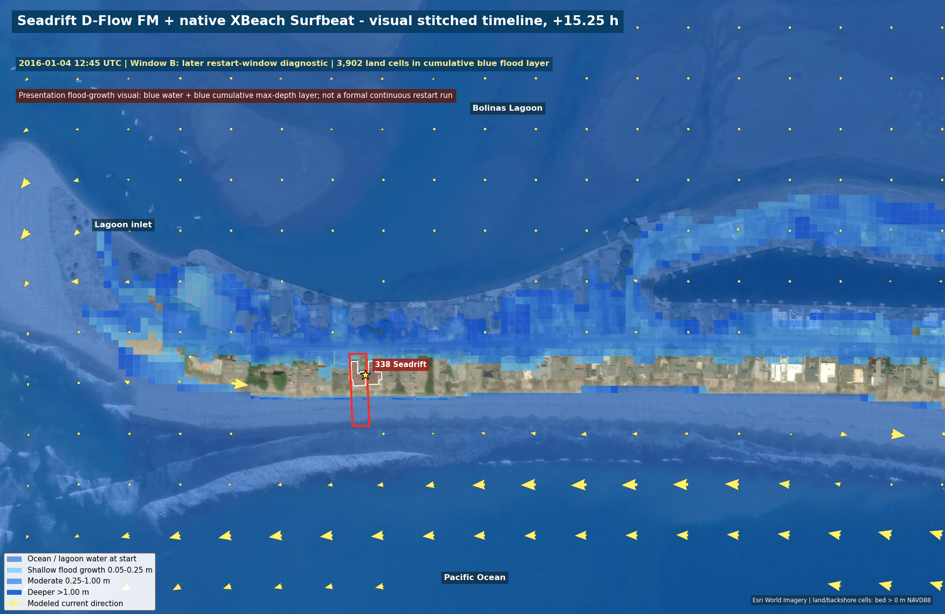
The Seadrift run resolves the ocean beach, lagoon, inlet throat, road, revetment, and property at decision-scale resolution. This presentation timeline starts from a dark-blue ocean/lagoon baseline, then accumulates blue depth-ramped land flooding as two same-mesh output windows advance.
Visual stitch
Seadrift Surfbeat flood-growth timeline
The 15.25-hour judge-facing timeline shades ocean and lagoon water blue from the start, then accumulates flood-growth cells through the early 30-hour checkpoint and later same-mesh diagnostic window. Darker blues indicate higher cumulative depth. It is for visual interpretation, not a claim of one seamless continuous restart run.
- Stitched high-resolution terrain and bathymetry
- Native Surfbeat inside D-Flow FM
- Same-grid handoff with visible model-status caveat
Final competition demo · 2:58
From planning screen to traceable coastal physics
The final OpenAI Build Week cut connects the address-scale problem, annual-chance Stockdon planning screens, native-Surfbeat evidence, provenance, and the Codex + GPT-5.6 workflow.
Latest 3D visual
Seadrift · oblique Surfbeat depth render
The stitched depth fields are rendered as an oblique 3D scene with OSM buildings, property labels, blue water-depth bands, and the same visual-stitch caveat.
Decision context
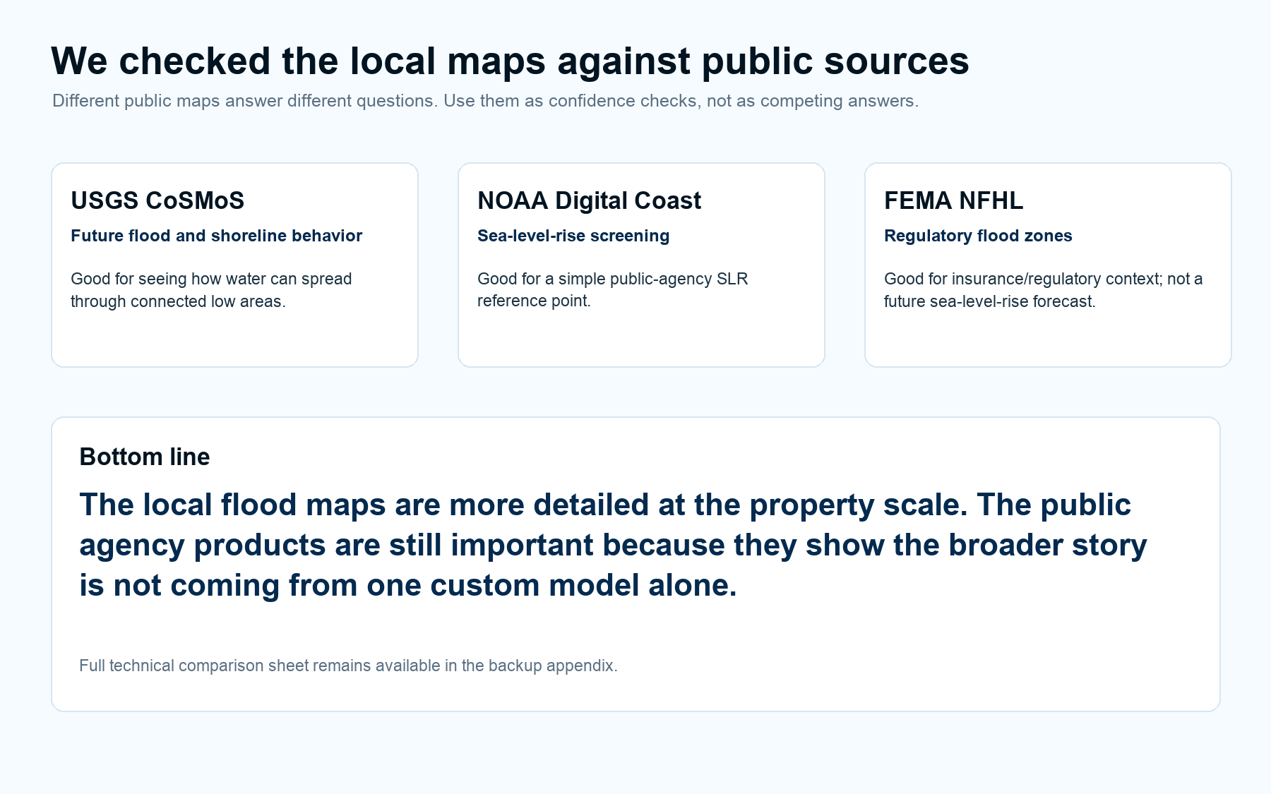
Seadrift · public layers versus local detail
Regional hazard products provide context; ShoreCast preserves the property, inlet, lagoon, and shoreline detail needed to explain pathways.
Competition preview
50% Stockdon flood progression
The original Stockdon planning-screen sequence, with return periods expressed as annual-chance percentages.
Built with Codex + GPT-5.6
AI did not replace the model. It made the modeling workflow executable.
Codex and GPT-5.6 connected work that normally lives in separate notebooks, GIS projects, manuals, model GUIs, Windows runs, and review conversations. The result is faster iteration with a visible chain of evidence.
Inspect the evidenceRecovered expert practice
Converted prior model setups and specialist discussions into explicit, reusable grid and coupling rules.
Orchestrated the toolchain
Prepared data, generated configurations, launched Windows solvers, watched health, and preserved immutable baselines.
Automated scientific QA
Compared observations and models, checked provenance and stability, and blocked unsupported validation claims.
Translated results
Turned NetCDF outputs into synchronized figures, animations, manifests, and a plain-language decision story.
The ShoreCast promise
One address. Traceable evidence. A visual answer.
ShoreCast makes high-quality coastal modeling easier to repeat, audit, and communicate—so specialists spend less time moving files and more time judging risk.